Tuesday 26 September 2017

Notices to Mariners Week 40 - Notices to Mariners for the Southern East Coast of the UK and across to France, Belgium and part of Holland

Permanent

Only news in the monitored area about three new editions of Admiralty Charts (on 19th October):

Chart 1185 - International Chart Series, England - East Coast, River Thames, Sea Reach. 1:25,000
Chart 1186 - England - East Coast, River Thames, Canvey Island to Tilbury.
A Canvey Island to Coalhouse Point. 1:12,500
B Coalhouse Point to Tilbury. 1:12,500
Chart 2151 - England - East Coast, River Thames, Tilbury to Margaret Ness. 1:12,500

Temporary

1. GRAVESEND REACH - CHIMNEY DEMOLITION - EXCLUSION ZONE - from 7.00am on Thursday 28th September 2017 an exclusion zone will be established in front of the Tilbury Power Station for the demolition of the two chimneys. See image on the usual page: http://www.crossingthethamesestuary.com/page9.html (in the Temporary List);
2. ST CLEMENTS REACH - GRAYS TERMINAL - JETTY WORKS & DREDGING OPERATIONS - from today for Jetty Works and Dredging for four weeks from 16th October (Image on the usual page);
3. DARTFORD CREEK - DARTFORD CREEK BARRIER - INSPECTION AND MAINTENANCE WORKS - inspection and maintenance works on the Dartford Creek Barrier from Tuesday 10th October 2017 until Thursday 12th October 2017. Navigation closed;
4. Potton Bridge Survey Work - Closed for navigation for 4th and 5th October;
5. Raysand Middle Buoy - off station and missing (wonder if it has sunk - eek!);
6. Dredging Operation in the Brightlingsea South Channel 8th October to 20th November - only pass with permission from the HM;
7. Dredging in the Port of Wells.


Link to details -
http://www.crossingthethamesestuary.com/page9.html

Local NtMs compiled by and reproduced by kind permission of Roger Gaspar, author of Crossing the Thames Estuary


Tuesday 19 September 2017

Notices to Mariners Week 38 & 39 - Notices to Mariners for the Southern East Coast of the UK and across to France, Belgium and part of Holland

Week 38

Permanent

1. ENGLAND - East Coast - Approaches to Lowestoft - Radar beacon. - this is an addition onto one of the wreck markers positioned over the wreck of the old tug 'Ella'. The wreck buoys were notified in week 34. Usual update of an image of the position at: http://www.crossingthethamesestuary.com/page9.html ;
2. NETHERLANDS - Approaches to Westerschelde - Galgeput - Depths. - a single reduction of depth in the Galgeput (northerly approaches to the Westerschelde);
3. ENGLAND - South East Coast - Fairy Bank NW - Wreck. - a new wreck but at 47m won't trouble us.

Temporary

1. Havengore Bridge is out of action by dint of mechanical trouble. To be repaired as soon as possible;
2. Port of London schedule of Woolwich Barrier Maintenance closures for November to April;
3. RIVER MEDWAY – SALTPAN REACH - Isle of Grain Liquefied Natural Gas Terminal - Jetties 8 & 10, Fender Panel Inspection and Maintenance - on or about Monday 18th September 2017 for 10 days;
4. LOWESTOFT – LARGE SEMI SUBMERGED PIPES – UPDATED INFORMATION - All the pipes in harbour but subject to maintenance;
5. Harwich Haven Maintenance dredging - dredging has started - Dredging will take place in the following areas: Channel edges (Buoys 1-8), outer channel and the Beach End bend and Harbour dredging around 11th September until approximately 19th September.
Week 39

Permanent

1. Admiralty Charts to be published 12 October 2017 - Chart 3741 - International Chart Series, England - East Coast , Rivers Colne and Blackwater.
2. ENGLAND - East Coast - River Medway - London Thamesport and Queenborough Harbour - NM Blocks. Drying height. Depths. Wrecks. - A chart block regarding the Thamesport Jetty, a reduced depth over the wreck on the Stoke Shoal, a reduced sounding off Queensborough (5m) and a drying height on the buoyed channel south off Queensborough (3.2!)
3. ENGLAND - East Coast - Greater Gabbard Wind Farm - Works. Legends. - just showing the wind farm is under works;
4. FRANCE - North Coast - Boulogne-sur-Mer - NM Block. Note. - a useful up to date chartlet via the UKHO chart block of the Boulogne Inner Harbour - not that that much has happened;
5. ENGLAND - East Coast - Lowestoft NE, E and SE - Depths. Wreck. - 8 reduced soundings and a new wreck off the shoals offshore from Lowestoft. All plenty of water so not likely to hinder leisure craft.

Temporary

1. Trinity House - the marked anchorage for the Semi submerged pipes is now removed;
2. Oyster dredge survey in the Crouch, today and tomorrow subject to weather;
3. LOWESTOFT INNER HARBOUR – WRECK AISHA – UPDATED INFORMATION - the condition of sunken vessel ‘Welsh Conquest (Ex Aisha)’, in position 52° 28.60’N, 001° 43.225’E, (alongside
Harbour Road Jetty) The vessel appears to have moved so that the stern of the vessel now encroaches into the Northern edge of the main navigational channel. The vessel’s upper housing has
also started to break apart, and the yellow flash light is no longer on station.
4. Port of Wells - dredging.

Usual page for images: http://www.crossingthethamesestuary.com/page9.html


Local NtMs compiled by and reproduced by kind permission of Roger Gaspar, author of Crossing the Thames Estuary


Thursday 14 September 2017

Lobster pots campaign – sign the petition!


WOA Logo

Reproduced from the Westerly Owners Association

Lobster pots campaign – sign the petition!

The Cruising Association has re-started the parliamentary petition on the government website following the general election.

Poorly marked lobster pots and fishing gear are a significant hazard for coastal cruising people. Fishermen, too, lose expensive gear as a result of entanglements. In one year alone, the RNLI has dealt with 295 incidents of fouled propellers.

It is time to work together to find a solution that is cheap and practical for fishermen. With this aim, the CA hopes to secure a government consultation about the effectiveness of the current guidance and the merits of enforceable regulations for the whole of the UK. We are seeking a consensus amongst fishermen's organisations as well as the RYA, RNLI and others concerned with yacht safety.

If you support our campaign, please: sign the petition, even if you had already done so, as previous votes can't be carried over

You can also report incidents to the CA via this address, or the RYA via this form. Tell your friends, family and club members about the campaign and petition.

It's time to change the rules, for safety's sake.

Good, and worry-free, sailing,

Tuesday 5 September 2017

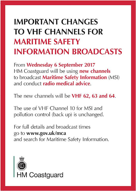
As of 6th September 2017 the VHF MSI channels are changing. These are the channels used to transmit weather and safety information. The broadcasts will continue to be announced on channel 16 with the areas covered by which channel.

Boat owners, shipping companies and anyone who puts out to sea need to make sure they’re ready for the changeover of some VHF channel numbers used to contact UK Coastguard.
The changes to Appendix 18 (Marine VHF) of the Radio Regulations mean that existing channels will no longer be used for either Maritime Safety Information (MSI) or Radio Medical Advice.
From 6th September 2017, channels to use will be VHF 62, 63 and 64. The use of VHF Channel 10 for MSI and pollution control (back up) is unchanged.
Mark Lawson from the Maritime & Coastguard Agency said: ‘We’ve been putting information out about the changes for some months now and will continue to do so in the weeks running up to the changeover.
‘This is an absolute changeover so people do need to be ready to start using the channels from 10am on 6th September. Although the MCA will keep the existing channels for about a year, they will not be routinely monitored. Your existing VHF radios should already have the new channels, but owners should check.’

Q&A
Why are the channels changing?
The changes are as a result of the World Radio Conference where it was decided that some channels should be removed and allocated for digital use. It’s a simple change to other VHF frequencies.
What difference will it make to boat owners and operators?
There will be no difference to the service provided. MSI broadcasts will still go out at the existing published times, just on the new channels. Those listening on Channel 16 will be directed to the appropriate channel, when the forthcoming broadcast is to be made.
What will happen if I use the old channels after 6th September?
The old channels will be retained by the Maritime & Coastguard Agency for about a year. However, they will not be routinely monitored as the MCA will redirect people to the appropriate channel that the MSI broadcast will be made on. Boat owners requiring Radio Medical Advice should initially call on Channel 16. They will then be directed to a working channel (62, 63 or 64).
What should boat owners and operators be doing?

Make a note of the replacement channels so that they are ready for the changeover day. Your existing VHF radios should already have the new channels, but owners should check. 

Notices to Mariners Week 35,36 &37 - Notices to Mariners for the Southern East Coast of the UK and across to France, Belgium and part of Holland


Week 35 & 36

Apologies for rolling the two weeks together (i.e. waiting a whole week's wait!)

This week (36), no permanent NtM in the monitored area. Week 35 there are:

1. ENGLAND - South East Coast - Dover Strait - Legends. Notes. - new annotation regarding Military Wrecks for many charts - this one is about one wreck south of Dover.
2. ENGLAND - East Coast - River Tyne S to Lowestoft - Legends. Notes. - similar annotation from the Humber down to Lowestoft - 2 wrecks in the monitored area, the third is north of the Humber;
3. ENGLAND - East Coast - Corton Road - Depths. - 3 reduced depths in the Corton Road but all more than 6.8m;
4. ENGLAND - East Coast - Gravesend Reach - Depths. - one reduced depth on the edge of the Thames channel in Gravesend Reach, still has 6.9m;
5. BELGIUM - Nieuwpoort Bank S, Grote Rede and Negenvaam N - Buoyage. Wreck. - a cluster of new buoys at a previously marked wreck north offshore off Nieupoort and a new wreck shown north off Ostende but with over 7m;
6. ENGLAND - East Coast - Thames Estuary - Traffic separation scheme. - Change later this year showing a change in the edge of the Precautionary Area in the Long Sand Head.

Temporary

1. Trinity House have placed two wreck buoys to mark the north and south extremities of the Anchorage for that long long huge pipeline that got loose. It is now anchored off Sea Palling and well worth avoiding: Image on the usual page http://www.crossingthethamesestuary.com/page9.html (in the Temporary list)
2. Port of Wells dredging;
3. Lowestoft reminding ALL including leisure users that craft must radio in before coming in or out or just moving about.VHF 14 or the telephone if no radio;
4. APPROACHES TO THE RIVER MEDWAY - NORE SWATCH BUOY OFF STATION;
5. DARTFORD CREEK - DARTFORD CREEK CLOSED TO NAVIGATION - until 8th September for critical repairs.
6. Inner Whitaker now has its topmark back;
7. Maintenance of Stow Creek, buoyage removed for two weeks work.

Week 37

Permanent

1. ENGLAND - East Coast - Thames Estuary - Traffic separation scheme. - just an addition to a legend in the title of each of the relevant charts for the change reported in Week 35 about the alteration of line of the TSS at the Long Sand Head;
2. ENGLAND - East Coast - River Medway - Rochester - Wreck. Depth. - a new wreck off Gashouse Point, near the ship buoys before the Rochester Bridge;
3. ENGLAND - East Coast - Holm Channel and Corton Sand W - Depths. - Two reduced depths in the Holm Channel. The Scroby Sands encroaching to the west (i.e. the eastern side of the Holm Channel).
4. FRANCE - North Coast - Banc In Ratel NE - Automatic Identification System. Addition of AIS on the DY2 south cardinal buoy marking the Dyck channel offshore north of Dunkerque.

Temporary

1. RIVER MEDWAY – SALTPAN REACH - Isle of Grain LNG Terminal, Jetty No. 10 River Works and Diving Operations - on Saturday 9th September 2017, between the hours of 13:00 and 17:00 a section of unloading arm will be removed from LNG Berth No. 10 by crane barge.
2. THE SWALE - QUEENBOROUGH CREEK FLOOD BARRIER - as of today’s date until the 31st of December 2017 works are being undertaken to refurbish the aging structure of the Queenborough Creek Flood Barrier and replace the steel gates. To undertake the in-channel works, the barrier will be taken out of action for a period of time, during which navigation through the structure may be impacted.
3. LOWESTOFT – TRANSITS AND MOORING ARRANGEMENTS OF LARGE SEMI SUBMERGED PIPES - commencing 30/08/2017, the first of a series of tows of semi submerged pipes will arrive off Lowestoft. It is anticipated that only one pipe will be brought into port at a time and moored on North Quay (berths 3, 4, 5) for maintenance and inspection purposes, then towed back out of the port. The total length of the tow will be approx. 300metres. These convoys are expected to enter and leave the port over the HW or LW slack periods.
4. Passage Plan - Lowestoft Port and Approaches - Mariners and Port users are advised that the UKHO has recently published a new edition of navigational chart BA1535, Lowestoft Port and
Approaches. A copy of the chart is attached indicating the tracks likely to be followed by commercial vessels entering and leaving the port of Lowestoft. Masters and Skippers of leisure craft and small vessels should use this information when planning their own passage in the vicinity of the Port of Lowestoft. The chart is also published on the Port’s website but you can download the pdf at http://www.crossingthethamesestuary.com/page9.html in the Temporary List (scroll down);
5. Port of Wells - dredging;
6. BRADWELL POWER STATION - BRADWELL INTAKE STRUCTURE - RIVER BLACKWATER, Magnox Limited has been granted license by the Marine Management Organisation to undertake the removal of handrails, access platforms and timber fenders from the Bradwell site outfall structure.
7. River Crouch – Maintenance of Channel Marker Buoys at Stow Creek - the Channel Marker Buoys at Stow Creek in position are now back on station.
8. Blakeney Harbour - Anyone interesting in the local chartlet and extensive information can be found via a link to their web site in the Temporary List on http://www.crossingthethamesestuary.com/page9.html

Read more at http://www.ybw.com/forums/showthread.php?486326-Notice-to-Mariners-Week-37#4pXH6JfPhyIJr7FG.99


Local NtMs compiled by and reproduced by kind permission of Roger Gaspar, author of Crossing the Thames Estuary