Permanent
1. New Editions of ADMIRALTY Charts on 11th January, 2018 - Chart 1351 - France - North Coast, Approaches to Calais
2. ENGLAND - East Coast - Stanford Channel - Depths. Foul. Buoy. - A collection of 7 reduced depths in the Stanford Channel with a group around the Newcome Sand PHM buoy (which is also slightly moved. But not critical to leisure craft.
Temporary
1. Medway (Peel Ports) Isle of Grain BP Jetty Lifting Operations - from the 16th of December 2017 for 4 days, the crane barge ‘Tilman’ will undertake lifting operations alongside BP number 1 berth on the Isle of Grain;
2. Approaches and within the Burnham Yacht Harbour Marina - dredging campaign from 21st December to 31st May 2018 - must be a significant campaign;
3. Approaches to Lowestoft (ABP Ports NtM) reported that depths are better and now are not less than 4.7m CD;
4. Mutford Lock, Norfolk Broads - closed for maintenance 5th February to 9th February;
5. Approaches to the Wash Ports - trenching works and survey in three places from 23rd December(!) to 10th January. One location is deeply inland so I assume it is a typo which makes it on the Sunk Sand off Hunstanton (so well out of the way) and the other two are beyond the area I monitor being north off Skeggie (who some may know it as Skegness).
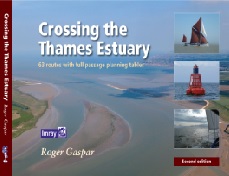
Local NtMs compiled by and reproduced by kind permission of Roger Gaspar, author of Crossing the Thames Estuary